Tuesday, September 28, 2021

Why Home School can be the best option. Unless of course you want your child dumbed down.


Dems Gotta go to Gitmo

 On the positive side I have no AC and I don't travel out of my state and don't fly etc. Natural survivalist from little up. Having said this, we really need to get the NWO out of our country along with their Satanic soldiers in politics, our military and the new rich sexual deviants in corporations favored by Dems. Time to reclaim all of our farmland away from Foreign and NWO owners. We need to shut down the UN, kick out all the diplomats. Bring our diplomats home (All diplomacy will be handled by phone by the elected president and no one else) and kick them out of office. Cut our federal departments to just National Defense and close and secure all of our borders and sea ports. End the World Bank System and base our currency on Gold. Guarantee  health freedom and end socialized medicine. End all income taxes and property taxes. Change to a ten percent State and ten percent Federal sales tax that will never be increased. It excludes essentials like food, RX, fuel, housing, transportation, education, investments, interest income, prize money, you get the idea. And one two year term limits for all legislators with salaries paid by their state at the rate equal to their district's average. They all work from home and each legislator is responsible for writing two bills and eliminating two antiquated laws every six months. They all come up for a general legislative vote and then passed on to the President for a thumbs up or down. They will have a cost analysis with each one. They no longer will be in charge of the general budget. That will be determined by the President and the cabinet and can be no longer than ten pages. It will come to a general public vote just as the public votes for amendments in their states. Legislators will get no free stuff at all including travel and staff. There will be no committees, majority or minority leaders all legislators will be the same. One Fed job limit and one two year term. NO more career politics. Lifetime benefits end permanently. No lobby groups allowed. This will be a true public service. 

China 3 Gorges Dam


Compensation for vaccine damage


Saturday, September 25, 2021


Shades of the French Revolution

 With the World Elite's plans to reduce our numbers thru abortion, lab created diseases, limited simple and successful medicines and this plan for a carbon created credit card it is little wonder for me now why the French Revolution happened under the French Elites of their day thinking the taxation and restrictions of the basics of life was going have a positive result. The end for the Elites today will not be so elegant. And the Mob not so discriminating. Many nuevo elites will suffer the consequences of their illegal enterprises for personal power and graft. And the private islands and bunkers will be eliminated quickly. 


HURRICANE CENTRAL

Hurricane Sam Forecast to Become Category 4 in Central Atlantic; Teresa Forms

By weather.com meteorologists

9 hours ago

At a Glance

  • Sam became the eighteenth named storm of the 2021 Atlantic hurricane season Thursday.
  • It rapidly intensified into the seventh hurricane of the season by Friday morning.
  • It will likely intensify into a major hurricane by Saturday.
  • It's uncertain whether it will pose a threat to parts of the Leeward Islands, or curl northward.
  • It will move slowly, and may not arrive near the Leeward Islands until mid-next week.

Hurricane Sam is intensifying in the central Atlantic Ocean and will soon become a major hurricane. However, it's uncertain whether it will strike the Leeward Islands next week. A new subtropical storm has also formed near Bermuda, but will not have any impacts in the U.S.

Sam became the seventh hurricane of the 2021 Atlantic hurricane season early Friday morning just 24 hours after it was Tropical Depression Eighteen.

Sam is still over 1,000 miles east-southeast of the northern Leeward Islands moving west.

An Uncertain Future For Leeward Islands

Despite Sam's expected rapid intensification, it's not yet clear if Sam will ever threaten land, but it will slow down.
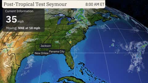
image
Current Info, Projected Path
(The red-shaded area denotes the potential path of the center of the tropical cyclone. It's important to note that impacts (particularly heavy rain, high surf, coastal flooding, winds) with any tropical cyclone usually spread beyond its forecast path.)

Sam's forward speed will slow this weekend, as high pressure to its north acting as its initial steering wheel weakens.

According to the latest computer forecast models, Sam may not reach the longitude of the Leeward Islands until next Wednesday or Thursday.

Whether it passes over parts of the islands or bypasses them to the north is still unclear, at this time.

Enjoy The Outdoors With This Portable Outdoor Fan (SPONSORED)

Residents in the Leeward Islands should monitor the latest forecast for any possible changes.

Beyond that, the large majority of computer model forecasts eventually curl Sam away from the U.S. East Coast late next week or next weekend.

That's because they're forecasting a weaker, less expansive Bermuda High over the Atlantic Ocean and a stronger trough, or southward plunge of the jet stream, near the East Coast, as described in a previous article here.

That pattern would cause Sam to curl north, then northeastward into the central or western Atlantic Ocean, rather than simply plowing westward.

Sam could at least generate high surf and rip currents along the East Coast more than a week from now even if it stays well offshore, as Hurricane Larry did earlier this month despite passing east of Bermuda.

Sam On the Way to Becoming an Intense Hurricane

Advertisement

Sam is in an environment conducive for intensification into at least this weekend, including low wind shear and increasingly warm water.

image
Current Satellite and Wind Shear
(Areas of clouds are shown in white. Areas of strong wind shear, the difference in wind speed and direction with height, are shown in purple. High wind shear is hostile to mature tropical cyclones and those trying to develop. Locations of active named storms and disturbances are also plotted.)

In this environment, Sam is expected to become a formidably strong hurricane, at least Category 3, by Saturday.

Beyond that, Sam's environment may become a tad less cooperative.

Fluctuations in intensity due to a replacement of Sam's eyewall beyond this weekend, but Sam is still expected to remain a formidably strong hurricane well into next week.

Sam is a small hurricane with both its tropical-storm-force and hurricane-force winds covering a small area relative to other hurricanes.

image
Current Wind Field
(The orange circle shows the extent of the system's tropical-storm-force winds (at least 39 mph). The purple circle indicates the extent of hurricane-force winds (at least 74 mph), according to the National Hurricane Center.)

Rapid intensification - defined as an increase in maximum winds of at least 35 mph in 24 hours or less - is common in small hurricanes like Sam.

(MORE: Why Some Hurricanes Rapidly Intensify While Others Don't)

Sam became the eighteenth named storm of the 2021 Atlantic hurricane season Thursday, the second earliest "S" storm in Atlantic Basin history, behind only 2020's Sally, according to NHC hurricane specialist Philippe Papin.

Subtropical Storm Teresa Forms

A new storm formed Friday afternoon in the neighborhood of Bermuda and had sustained winds above 40 mph, making it the 19th named storm of the season. It is the second earliest 19th or "T" storm in the basin's history.

Teresa will meander northward in the open Atlantic and is not expected to bring impacts to any land.

Check back with us at weather.com for the latest forecast updates on Sam and Teresa.

The Weather Company’s primary journalistic mission is to report on breaking weather news, the environment and the importance of science to our lives. This story does not necessarily represent the position of our parent company, IBM.

HURRICANE CENTRAL Hurricane Sam Forecast to Become Category 4 in Central Atlantic; Teresa Forms By weather.com meteorologists9 hours ago At a Glance Sam became the eighteenth named storm of the 2021 Atlantic hurricane season Thursday. It rapidly intensified into the seventh hurricane of the season by Friday morning. It will likely intensify into a major hurricane by Saturday. It's uncertain whether it will pose a threat to parts of the Leeward Islands, or curl northward. It will move slowly, and may not arrive near the Leeward Islands until mid-next week. Hurricane Sam is intensifying in the central Atlantic Ocean and will soon become a major hurricane. However, it's uncertain whether it will strike the Leeward Islands next week. A new subtropical storm has also formed near Bermuda, but will not have any impacts in the U.S. Sam became the seventh hurricane of the 2021 Atlantic hurricane season early Friday morning just 24 hours after it was Tropical Depression Eighteen. Sam is still over 1,000 miles east-southeast of the northern Leeward Islands moving west. An Uncertain Future For Leeward Islands Despite Sam's expected rapid intensification, it's not yet clear if Sam will ever threaten land, but it will slow down. image Current Info, Projected Path (The red-shaded area denotes the potential path of the center of the tropical cyclone. It's important to note that impacts (particularly heavy rain, high surf, coastal flooding, winds) with any tropical cyclone usually spread beyond its forecast path.) Sam's forward speed will slow this weekend, as high pressure to its north acting as its initial steering wheel weakens. According to the latest computer forecast models, Sam may not reach the longitude of the Leeward Islands until next Wednesday or Thursday. Whether it passes over parts of the islands or bypasses them to the north is still unclear, at this time. Enjoy The Outdoors With This Portable Outdoor Fan (SPONSORED) Residents in the Leeward Islands should monitor the latest forecast for any possible changes. Beyond that, the large majority of computer model forecasts eventually curl Sam away from the U.S. East Coast late next week or next weekend. That's because they're forecasting a weaker, less expansive Bermuda High over the Atlantic Ocean and a stronger trough, or southward plunge of the jet stream, near the East Coast, as described in a previous article here. That pattern would cause Sam to curl north, then northeastward into the central or western Atlantic Ocean, rather than simply plowing westward. Sam could at least generate high surf and rip currents along the East Coast more than a week from now even if it stays well offshore, as Hurricane Larry did earlier this month despite passing east of Bermuda. Sam On the Way to Becoming an Intense Hurricane Advertisement Harness the power of personalized payment terms. Sponsored by Affirm Affirm’s Adaptive Checkout™ uses new technology to offer personalized payment plans in one clear view. As a result, it can help you accelerate conversions—and see more of them. Learn more about how Adaptive Checkout™ with Affirm can help you. SEE MORE Sam is in an environment conducive for intensification into at least this weekend, including low wind shear and increasingly warm water. image Current Satellite and Wind Shear (Areas of clouds are shown in white. Areas of strong wind shear, the difference in wind speed and direction with height, are shown in purple. High wind shear is hostile to mature tropical cyclones and those trying to develop. Locations of active named storms and disturbances are also plotted.) In this environment, Sam is expected to become a formidably strong hurricane, at least Category 3, by Saturday. Beyond that, Sam's environment may become a tad less cooperative. Fluctuations in intensity due to a replacement of Sam's eyewall beyond this weekend, but Sam is still expected to remain a formidably strong hurricane well into next week. Sam is a small hurricane with both its tropical-storm-force and hurricane-force winds covering a small area relative to other hurricanes. image Current Wind Field (The orange circle shows the extent of the system's tropical-storm-force winds (at least 39 mph). The purple circle indicates the extent of hurricane-force winds (at least 74 mph), according to the National Hurricane Center.) Rapid intensification - defined as an increase in maximum winds of at least 35 mph in 24 hours or less - is common in small hurricanes like Sam. (MORE: Why Some Hurricanes Rapidly Intensify While Others Don't) Sam became the eighteenth named storm of the 2021 Atlantic hurricane season Thursday, the second earliest "S" storm in Atlantic Basin history, behind only 2020's Sally, according to NHC hurricane specialist Philippe Papin. Subtropical Storm Teresa Forms A new storm formed Friday afternoon in the neighborhood of Bermuda and had sustained winds above 40 mph, making it the 19th named storm of the season. It is the second earliest 19th or "T" storm in the basin's history. Teresa will meander northward in the open Atlantic and is not expected to bring impacts to any land. Check back with us at weather.com for the latest forecast updates on Sam and Teresa. The Weather Company’s primary journalistic mission is to report on breaking weather news, the environment and the importance of science to our lives. This story does not necessarily represent the position of our parent company, IBM.


Wednesday, September 22, 2021

Ironic free movie on You Tube Goodbye World

https://www.youtube.com/watch?v=SYtni31jIMM

When a mysterious cyber-attack cripples civilization, a group of old college friends retreat to a remote country home, where they must cope with an uncertain future while defending themselves against desperate outsiders. 2014 GOODBYE WORLD, LLC 2014 Phase 4 Films (USA), LLC. All Rights Reserved. Phase 4 Films, the Phase 4 Films logo and all related titles, logos and indicia are trademarks of Phase 4 Films Inc. All Rights Reserved. Distributed exclusively in the United States by Phase 4 Films (USA), LLC. / 460 Greenway Industrial Drive, Suite A, Fort Mill, SC 29708 / 1.866.495.3650 / www.phase4films.com

Monday, September 20, 2021

Twitter Jail and apparently barred from Twitter because I would not delete an opinion

 They must think my opinions are more persuasive then I think they are folks. It was a week of tweeter jail and it was in my opinion uncalled for folks. So until then I remain Tru Justice.